
the old salt route
Written by sonia on . Posted in B&B liguria, hikers hostel, la Via del Sale, outdoor liguria, Trekking la via del Sale, trekking-cammini. Leave a Comment
the old salt route
the old salt route
From the car park overlooking the Staffora, follow the signs towards the bridge, then the path on the left. A wide path, first flat, then of variable slope, will take you to Monteforte and then to Castellaro, periodically intersecting the asphalted provincial road and the local cart track.
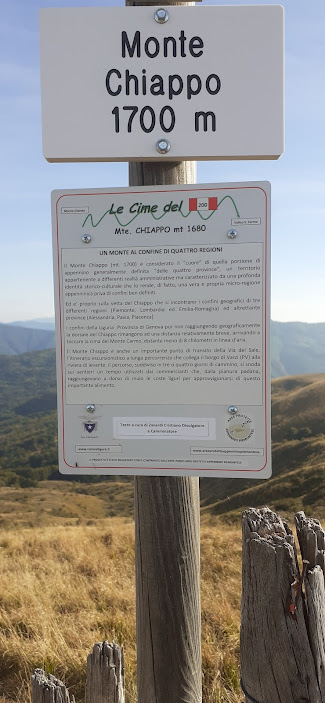
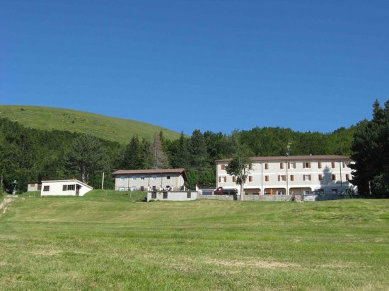
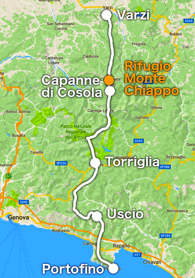
At the end of the town, continue along a wide dirt road surrounded by woods until you reach the border between Lombardy and Piedmont. On the border line, continue on the ridge that will accompany us up to the 1700m of Monte Chiappo, where at the bar / refuge it is possible to refresh yourself before the descent to the Capanne di Cosola (province of Alessandria, Piedmontese cuisine) or to Capannette di Pey where a large historic hotel there will welcome (Carlo and his wife are really super nice) with excellent Piacenza cuisine Albergo Capannette di Pey, www.capannettedipei.it Piacenza province, Piacenza cuisine.
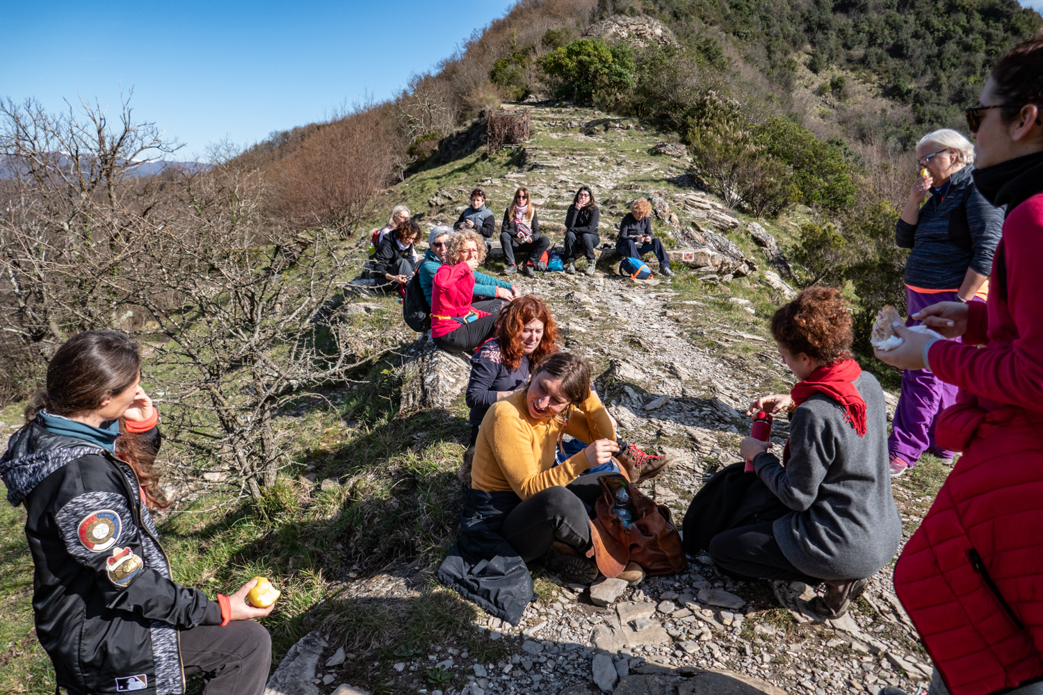
2 day Capannette-Torriglia marks the Via del Sale
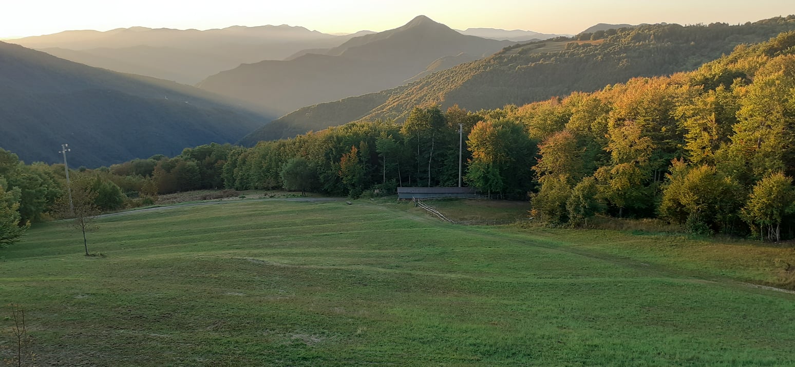
The second day of walking begins along another border: the one between Piedmont and Emilia, initially slightly downhill, first in the wooded area, then on the ridge overlooking the pastures below in a southerly direction. Once you have passed Monte Cavallaro and Carmo, the path continues on the dividing line between Liguria and Piedmont within the Antola park. The Antola Refuge has reopened but better call (January 2021) Reached the top of the mountain, or continue along the path staying low, continue steeply downhill towards Donetta and then Torriglia, where it is possible to stay overnight and take a nice ride in the village where I recommend you to buy the famous canestrelli and focaccia a Torriglia is exquisite, special sweets with spelled flour and cinnamon Super recommended Hotel della Posta the owner Mr. Pippo and his family have had this old hotel since 1906 in the town center and the food is very good, generous portions and excellent quality 010 944050
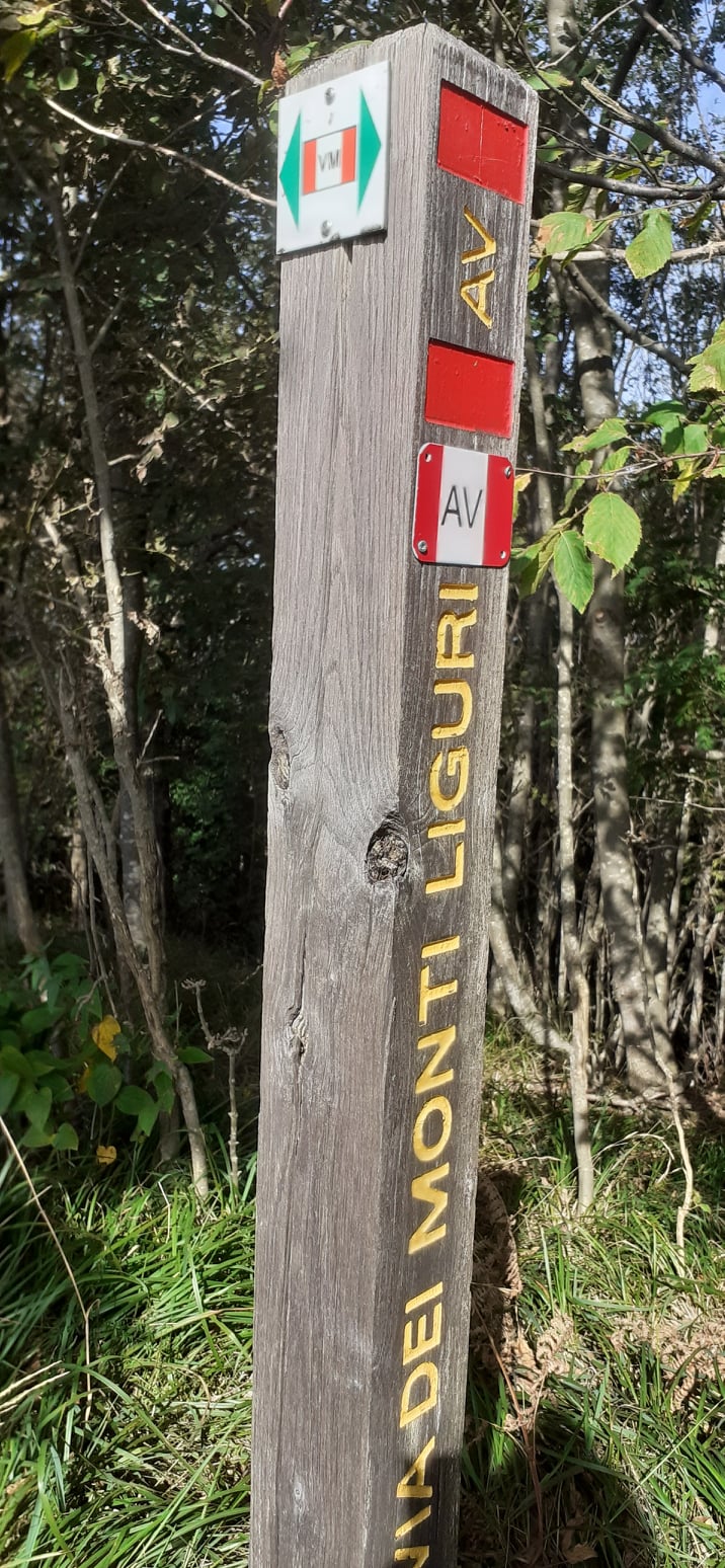
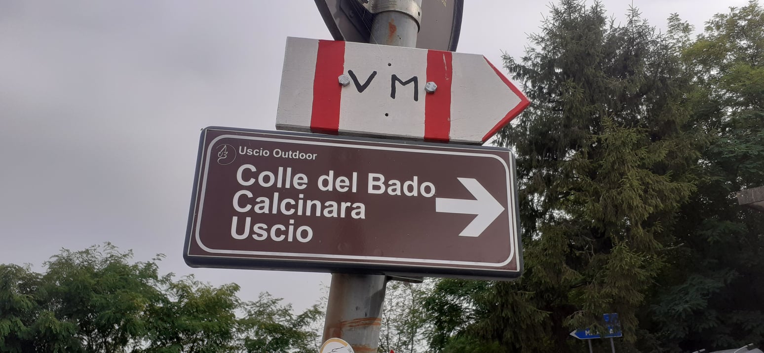
3 Torriglia-Uscio leg VM signpost
Continue and the VM path coincides with ALTA VIA dei Monti Liguri marked with the initials AVML, and now also georeferenced after about 2 hours of walking, when the path forks, on the right sign for Passo della Scoffera, while for La VM it is stay on the path going straightAlways follow the VM signs and when you arrive in Sant 'Allberto di Bargagli and, at the ROSABRUNA restaurant, follow the directions for the route with the new aluminum trail markers VM and go up (last climb) towards Monte Bado.
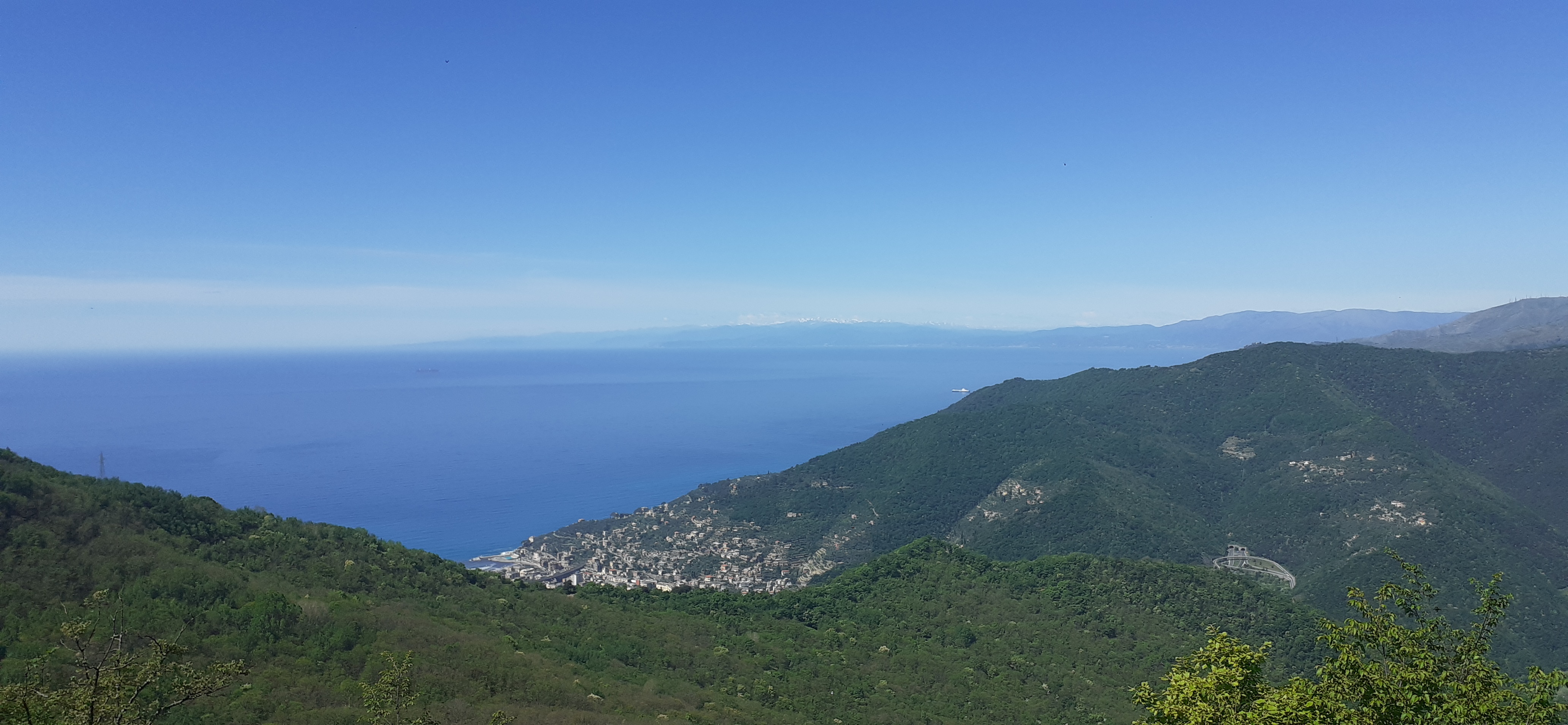
Once you arrive on Monte Bado, ALWAYS FOLLOW VM and CASE BECCO, once you arrive at CASE BECCO you are on the panoramic road of Monte Fasce Becco and you are right on top of the Golfo Paradiso with a mega view of the sea!Always follow for Case Becco, always VM, do not go to Pannesi signposted XX. just always follow VMAt Case Becco, always follow the VM signs.Once you arrive in Colle Caprile you have to take the path that you meet again going left, with the new VM sign, or go right and take the provincial road and go down to Uscio, ( downhill and shorter but obviously less interesting) then you will find a pink sign on the provincial road and turn left where there is the municipality of Uscio (via Bisagno) go up and after 300 meters you will arrive at the B&B Rifugio Uscio
If you want to do the VM instead, take the sign on the left then immediately a large path on the right marked VM and ISC which in large part coincide and always follow VM and after 30-40 minutes of walking, the path divides, on the left the via del Mare that goes up while you continue straight to get to the B&B Rifugio Uscio, along the dirt road towards La POLVERIERA-USCIO. Thanks to Uscio-Outdoor Association born in 2019 to improve the ancient paths of Uscio and enhance the Uscio area, especially the path of the Via del Mare and cut off the provincial road, recovering ancient historical paths of Uscio. a beautiful forest even chestnut trees)
Always follow for the Polveriera and arrive on an asphalted road, go right and go down, after 3 minutes you will find the sign B&B Rifugio Uscio and always follow the 3 red dots that indicate the VM connection that takes you to the B&B Rifugio Uscio, you will find on your left Pink sign, go down to the Creuza and you are there (we are in the town center above the church)
day 4 USCIO-Portofino park signpost VM
The B&B Uscio is right on the VM route, just above the large church of Uscio, in fact the FIE has signaled the creuza that leads from my structure to the VM (3 min walk) with 3 red dots. Then as soon as you get on the carriage road sign VM on the right and go up along the asphalted road. immediately follow the VM signs, always follow VM and walk half an hour on the asphalt following VM to reach Colonia Arnaldi, continue and always follow the VM signs and arrive at Passo Spinarola.
From Passo Spinarola, asphalt ends, and the journey begins, new signs of the Portofino Park with signs and new trail markers! Always remaining on our path, the VM path winds through the woods and you arrive at Passo del Gallo, from where you can observe the two Gulfs: Rapallo on the left and Recco on the right. The path continues without any problem, it is easy and well marked up to the crossroads that separates the road to Ruta di Camogli indicated by VM from that to Recco. (A triangle) .New variant for Rapallo towards Santa Maria Novella, the easiest compared to the Montallegro variant for Rapallo passing through the Manico del Lume, well signposted at Passo del Gallo
Shortly after you arrive on the paved road and turn left to reach Ruta. You arrive in the center in 10 minutes and go up the steps of the church of Ruta and the VM path becomes Ruta-San Fruttuoso, a wonderful and easy path (starting from Ruta and not from Ran Rocco which is more demanding) and you enter the Parco Di Portofino. From there to the summit of Monte di Portofino, then you can easily descend to Pietre Strette and then to Portofino or San Fruttuoso, where the clear water of the park will welcome you for a refreshing dip in the blue. Return by train from Camogli, Santa Margherita, Recco is recommended.
Tags: golfo tigullio, golfo tigullio, hikers backpackers, la via del mare, la via del mare, outdoor trekking liguria, paradise gulf, the old salt route, tigullio gulf, trekking liguria, trekking liguria